South Carolina), tides are large, the land is low, and estuarial salt marsh separates land from water. This gives rise to long causeways if one
wants to get to a boat. Wind Song is way out on the last outside dock.
We are way, WAY behind in our reporting -- we can scarcely believe how far -- and that's because we've been very, VERY busy. Once Tania got back to Florida from LA, we started moving Wind Song north pretty much as fast as we could, doing anywhere from 50 to 80 miles a day, then stopping for the night. We were underway ten to twelve hours each day, often getting up in the dark and raising anchor at daybreak. Our goal was to be in Oxford, MD by June 15th and expected that to be a challenge. As it turned out, we made it there on June 11th.
That's right. For practical purposes, our cruise on Wind Song is now OVER. As of today we have been cruising 254 days, and we have covered 2652 nautical miles. We have about 24 nmi left to go. That's the distance from here to Annapolis, MD, where we will lay up Wind Song. We've interviewed nine brokers, selected one, and have signed a listing agreement. She is officially FOR SALE.
We made it. We've done what we said. All that is left is to divest and return home. And get Roxanne into college. In terms of time, we have about six weeks remaining -- but they will be busy. For that matter, the past few weeks since Savannah have been almost a blur: day after day putting miles under our keel, interspersed with a few short but sweet tourist stops. There are so many stories to tell, and so little time. We are very close to -- gulp -- buying our airline tickets home. Good grief. . Wind Song will either be sold or on the hard by the end of July, and if the latter, will stay there until she is sold.
~~~~~~~~~~~~~~~~~~~~~~~~~~~~~~~~~~~~~~~~~~~
32°23.6'
N, 80°04.7'W
Beaufort, SC (ICW StM 540.5)
Wednesday, May 27, 2005
We stopped in at Port Royal Landing Marina just as we did 11 years ago aboard Daybreak, to visit with our old friend Larry Hines from LA. And he was so busy we didn't even manage to get a photo of him or meet his wife! In 1994 he was the Dockmaster, single, and living aboard his boat. In 2005 he is the Marina Manager, married, and living ashore in Beaufort (which pronounced BYEW fert in South Carolina).
We borrowed a courtesy car from the marina, ran some errands, and then did a driving/walking tour around historic colonial Beaufort. Every town on the East Coast is historic and colonial to some degree, and most have tried to preserve some of that heritage in museums and preserved structures. Beaufort SC is no exception, and they have done a good job.
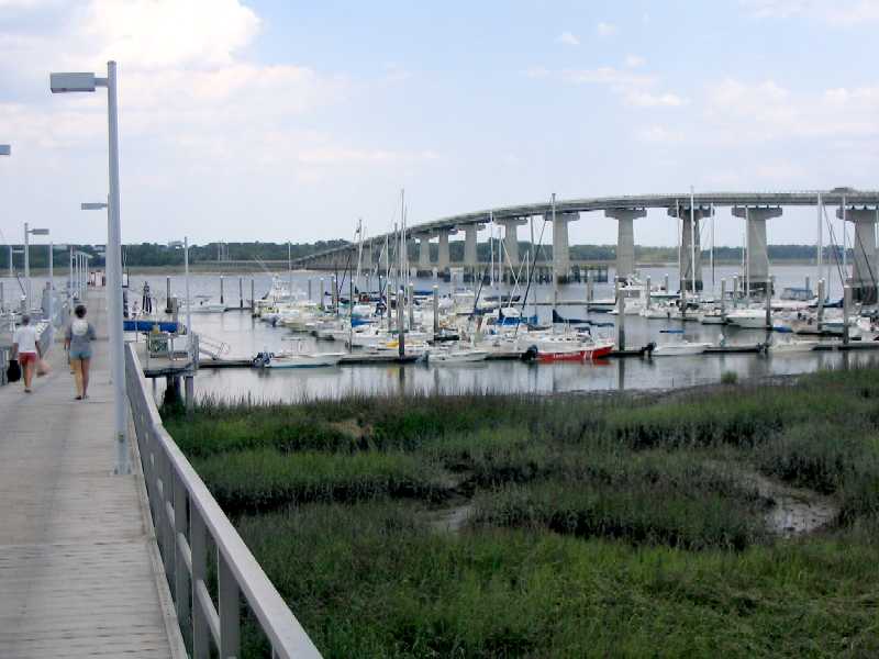
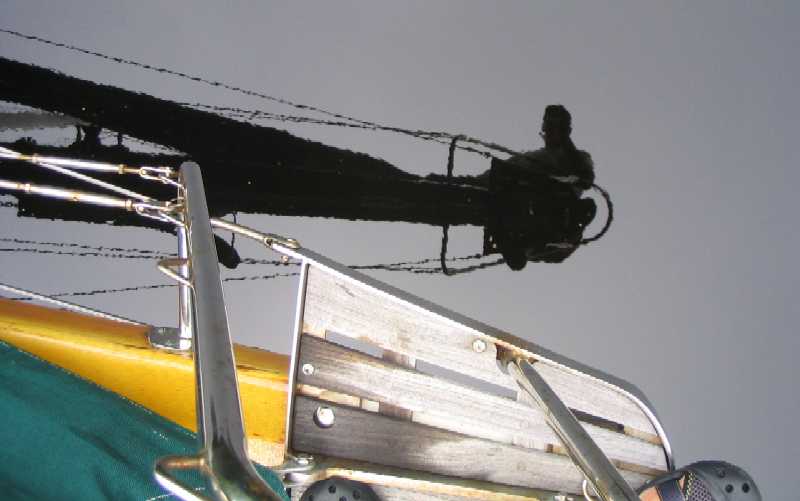
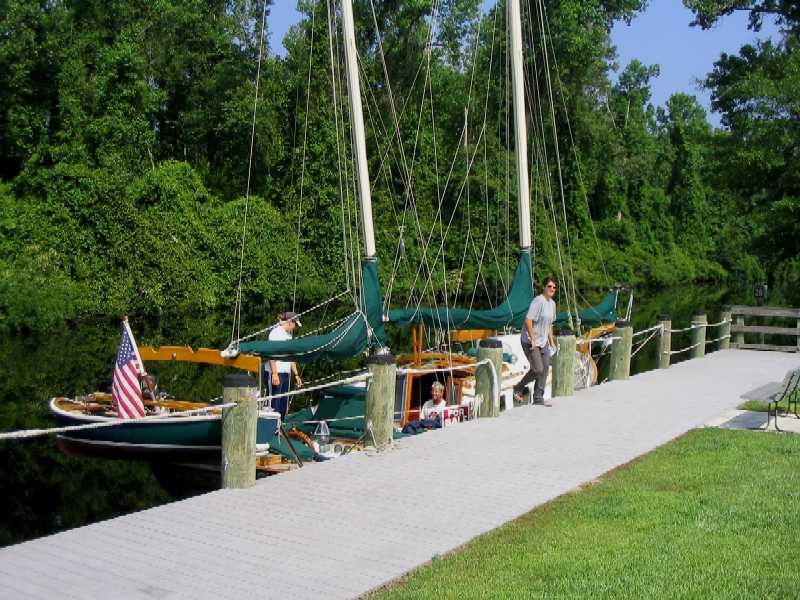
Port Royal Landing Marina, just north of the Lady's Island fixed
bridge. As everywhere in the Low Country (coastal north Florida, Georgia,
and
South Carolina), tides are large, the land is low, and estuarial
salt marsh separates land from water. This gives rise to long causeways if
one
wants to get to a boat. Wind Song is way out on the last
outside dock.
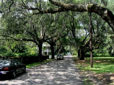
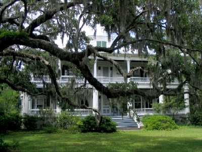
In historic residential Beaufort, streets are narrow and tree-shaded,
Spanish moss abounds, and the homes are Deep-South-sumptuous.
 _
_
 _
_
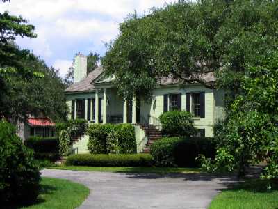
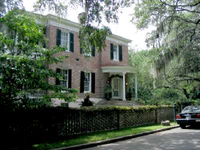
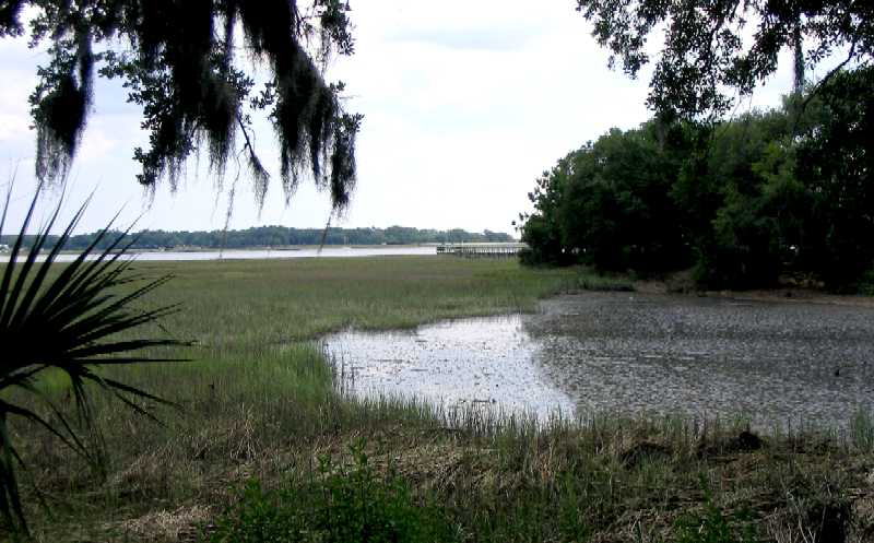
As everywhere in the Low Country, "high ground" and "dry land"
are more hopeful terms than factual. This photo is taken from nearly the
same
spot as the one above right, but in the opposite direction. That
lovely lawn sits about three feet above the high tide line, and behind it
the rest
of the town does not sit much higher. When a hurricane comes --
and this stretch of coast acts like a magnet for them -- the yard will be
flooded.
That is why all these houses sit on pilings above the ground, with
steps up to an elevated porch.
We headed out in the morning, our next intended stop Beaufort, NC.
34°43.5'
N, 76°48.2'W
Peletier Creek, NC (ICW StM 209)
Wednesday, June 1, 2005
Check this out. To get here we traveled 332 statute miles in 6 days, an average of 55 miles per day in narrow confines, shallow water,. twisty channels, with shoals on all sides -- outdoors, hand steering, eyeball navigation, no autopilot (and none possible), two people on duty at all times (a helmsperson and a navigator), and a lot of it in foulies, pouring rain, and adverse wind. Those miles may not sound like much, but this kind of travel is exhausting.
Now check this out: Having traveled 332 StM, we managed to cover only 247 miles "as the crow flies" (or as the boat sails . . . when it is on ocean, anyway). That's in a "relatively" straight stretch of the ICW. In Georgia the ratio is closer to 2x.
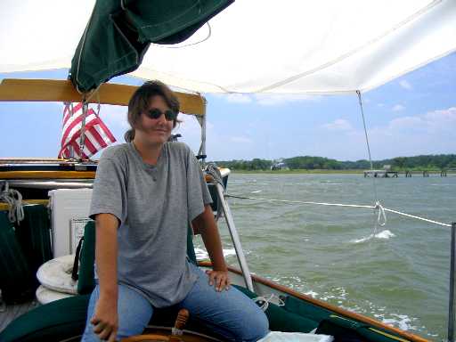
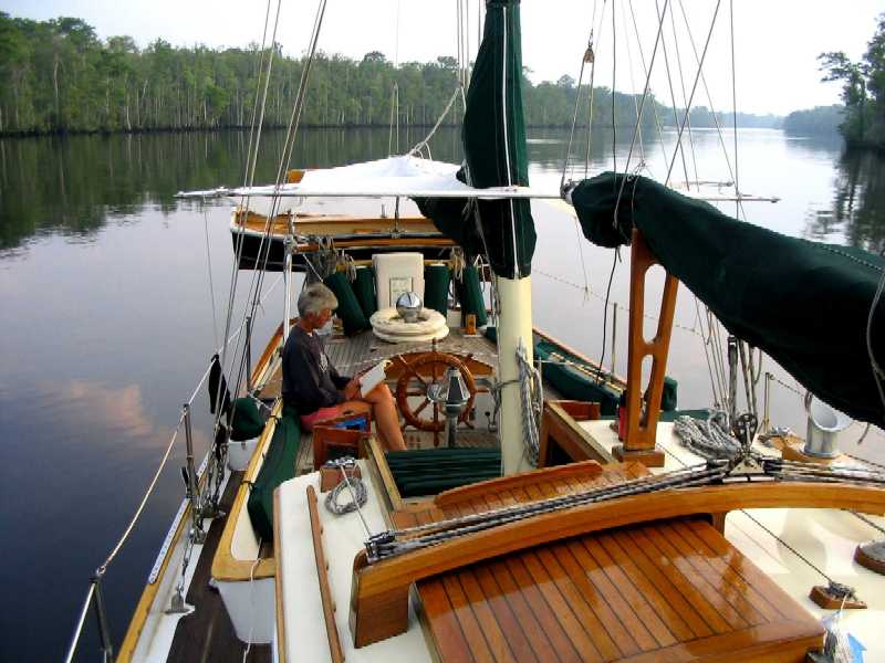
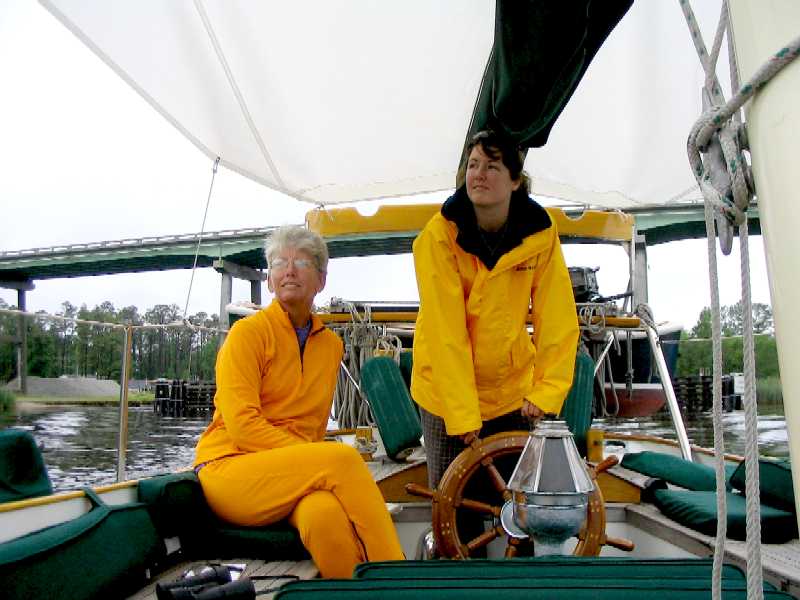
Roxanne steers her shift on the way to Morehead City while Lynn
hand-sews the quilt Roxanne will take to college. This stretch of ICW does
not require a navigator -- just keep the red markers to port and
the green to starboard.
 _
_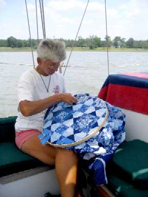
After anchoring through a rainy night, Lynn reads in the cockpit
over morning coffee.
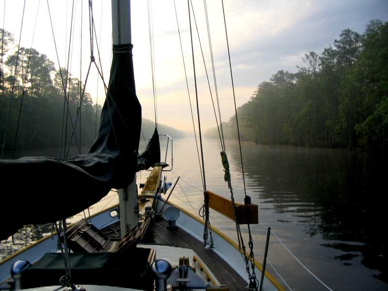
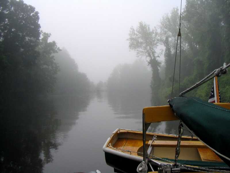
And then off we go again into the lingering fog and mist, another
steamy day in the Low Country.
So why Peletier Creek? We had good reason to go there. Do you remember Bob and Barb from the Colvin steel schooner Rhiannon, whom we met down in the Red Shank anchorage in Georgetown, Exumas? They're the ones who do all the spearfishing and brought us the lobster feast one day. This is where they live, in Morehead City, just across the river from Beaufort, NC (that's now BOE fort, in NC), working as nurses in the local hospital. We were there to visit them.
These folks have become two of our favorite people. They've lived a life most people can scarcely imagine, living aboard various boats while raising their children to adulthood, eking out an existence with one job or another between cruises. Barb has always been a nurse, but Bob earned his living as a welder earlier in life -- that's how he was able to build a 40 foot steel schooner by himself. Bob has always been into traditional sailing vessels, and he and Lane can talk the various merits and demerits of gaff and sprit rigs, sharpies and catboats, skipjacks and bugeyes, till everyone around them is rolling their eyes in boredom. These folks, now with grown children, work 18 months at a stretch at Carteret County Hospital, cruise for 6 months, then repeat, on 2 year intervals.
Now they, at last, are living in a house, which they have not done in something like 20 years -- and such a perfect house it is. We were instantly perfectly comfortable in their lovely little home. (But why say "little"? It vastly exceeds Rhiannon in size!) True to form, they bought a run-down fixer-upper, Bob went to work on it, and now it's a gem. Not fancy -- not so you'd be afraid to touch anything -- but perfectly thought out and executed for actually living in. And full of 20+ years of nautical memorabilia.
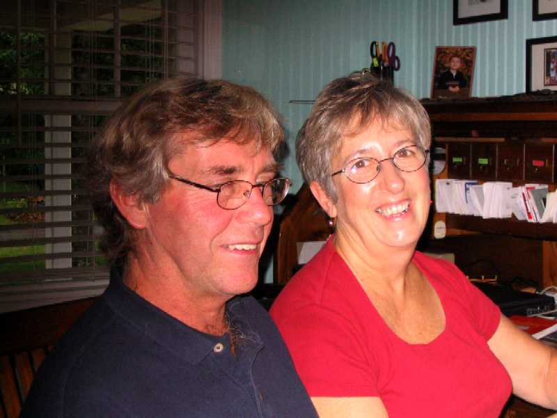
Bob and Barb Thomas, Peletier Creek, Morehead City
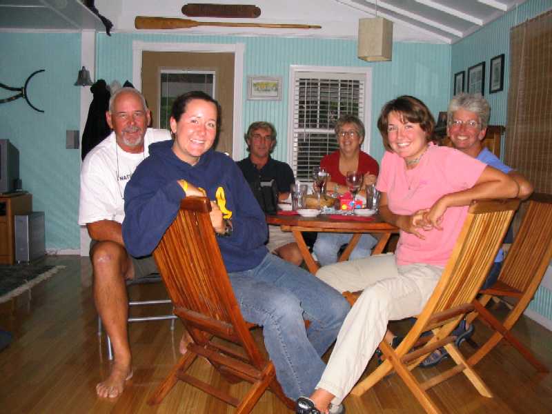
Group portrait at dinner with Bob & Barb.
While in the area Bob & Barb loaned us their old Plymouth Neon to get around town in, and the first place we went was the wonderful Beaufort Marine Museum, one of the best on the planet. It has a reading room/lending library that has the best collection of nautical books we've ever seen, in a supremely comfortable reading lounge reminiscent of a large private library in an English mansion. Roxanne and Lane spent the better part of a day in there while Lynn and Tania shopped.
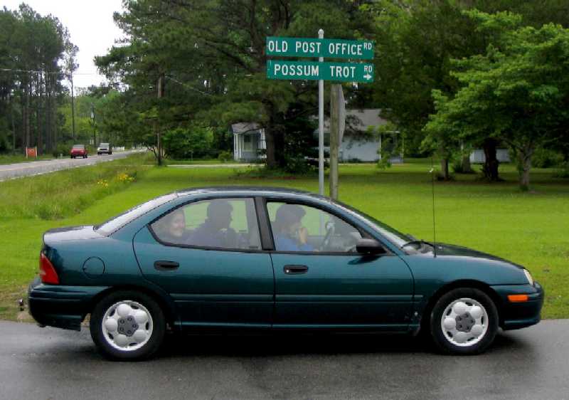
We also took
a ride through the rural areas north of town, and found one of the better
road signs we've seen.
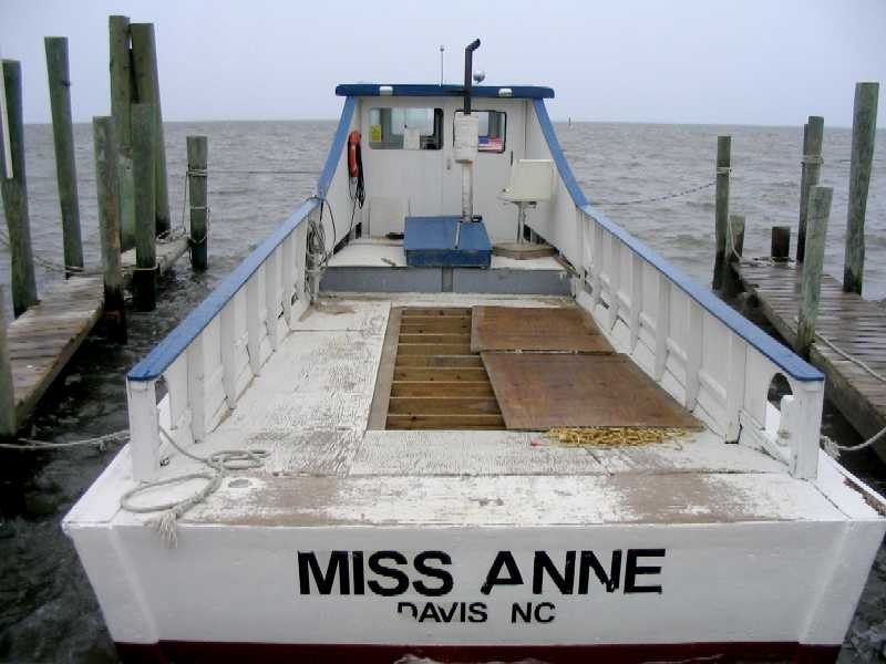
We drove north
ands east until we ran out of road at the "ferry terminal" out to Core Banks.
There we found three boats that all looked something like this one. The deal
is, you show up here in your $30,000 4x4 SUV loaded up with your buddies,
some camping gear, a bunch of guns and ammo, and way too much liquor, and
you drive onto a few sheets of plywood on this converted 35 foot deadrise
oystering boat. Then it takes you across Core Sound to the barrier island,
and picks you up however many days later you would like. No early pick-up,
no communication -- no cell phone service out here. Does anyone remember
the movie "Deliverance"?
Goat Island,
NC (ICW StM 44)
Saturday, June 4, 2005
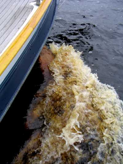
Our next destination
was Elizabeth City (StM 50), the southern entry point to the "other" inland
route to Norfolk, VA: The Great Dismal Swamp Canal. This is an area where
fallen leaves leach tannin into the water, turning it the color of Lipton
tea (yes, that's just plain sea water in the right-hand photo below, not
what you thought).
 _
_
Lynn and Roxanne navigate northward through bridges, rivers, creeks,
canals, and drizzle.
We have no photos of Elizabeth City -- it's basically just a small, relatively poor, industrial city in the backwoods and back waterways of North Carolina, known, as near as we can tell, primarily for two things: 1) the only Congressional lobby for keeping the Great Dismal Swamp Canal open to navigation, and 2) the birthplace of the Moth sailboat, an early high performance one-design catboat eleven and a half feet long that might be thought of as the antecedent to the modern Laser (13' 8") -- basically a skimming dish with an excitingly large sail.
We know it now also for a third thing: it boasts one of only six dinner-movie theaters in the country, one of only three on the East Coast. We tried it. We saw Star Wars Episode III. We liked it!
This town takes cruiser-friendliness to legendary levels. When you arrive, you tie up to the free transient docks at the foot of the city and a member of the Rose Buddies greets you and welcomes you. They used to give a single rose to every female abord every visiting yacht, but that practice has stopped. Now they host a wine and cheese party on the quay whenever four or more boats are in residence -- as they did when we visited. They want cruisers in their town, and they want the Canal to remain open so cruisers will come their way. The ICW used to come through Elizabeth City, but was diverted through a new, deeper cut to the east that is also slightly shorter. We've been through twice and haven't taken the new route yet. As long as we have less than six feet of draft, why would we miss that place?
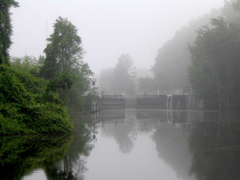
After anchoring north of the Elizabeth City drawbridge for the
night, we rose at dawn to try and catch the 0830 South Mills Lock opening
and found thick pea soup fog with perhaps 100 foot visibility.
We navigated slowly marker to marker until the fog burned off enough to see
at least a little. This photo was taken two hours later.
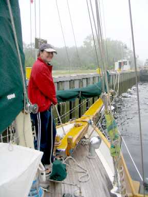
Perceived distantly through the remaining mist, as advertised the
lock opened promptly at 0830 to welcome us. We were the only boat.
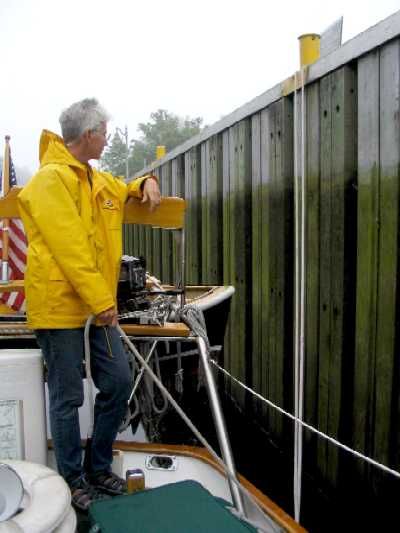
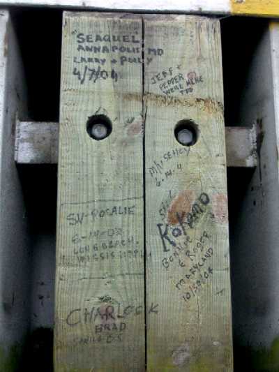
Lynn gets set to tend the stern line as water begins to flood the
lock. On the lock wall timbers, grafitti from cruisers we knew in the Bahamas.
 _
_
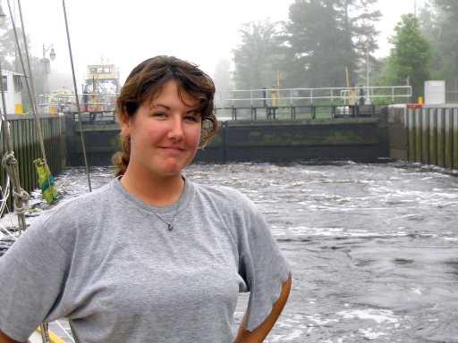
Roxanne strikes a pose as the entering water roils around us. Tania
tends the bow line as we approach high water level.
 _
_
And we're in the Canal -- which has exactly one bend in its 22
mile length, and clearly not visible in this photo!
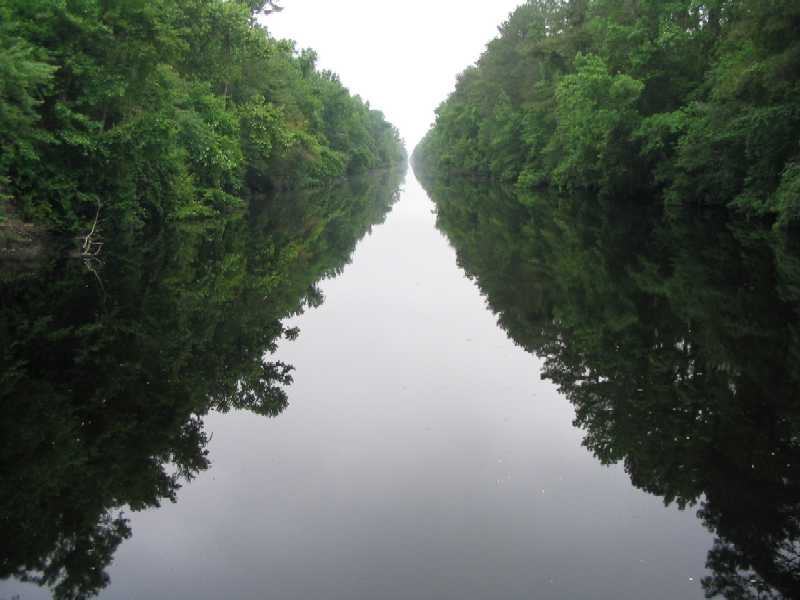
Talk about yer protected water!
A few miles in, we stop at the Dismal Swamp Visitor's Center/State
of Virginia Welcome Center. The state line runs across the canal.
Once out the north end of the canal we anchored for the night, then skedaddled in the morning for Sarah Creek, VA, 30 nautical miles away (finally we're out of the statute miles of the ICW!) at the mouth of the York River on the west side of the Chesapeake Bay. There we planned to meet Lane's cousin Randy Darnton, who would be coming down from Roanoke to meet us and spend two days with us acting as our guide to Colonial Williamsburg.
37°15.3'
N, 76°28.7'W
Sarah Creek, VA
Thursday, June 9, 2005
We have lots of photos, so many that we can't begin to show even a representative fraction, and that's just as well, because you really ought to just go there if you get the chance. A small word of advice: go when it's cool, like, y'know, March or April . . .
Yes, it was warm, but nowhere near the killer levels that will prevail in another month or two. Be that as it may, we enjoyed Colonial Williamsburg a lot. We were somewhat dismayed at the price ($45 per person per day), but after we'd been there awhile we figured out why it had to cost that much: all those folks in costume doing colonial crafts were not volunteer docents, they were full time paid employees, most of them exceptionally intelligent, well educated (advanced degrees), and conversant with not only the tiniest details of their craft but also of virtually the entirety of the sociopolitical surround that influenced life, labor, and commerce there in the 18th century. Regarding the crafts, they were, literally, Masters. Having served the requisite seven year Apprenticeship, they became Journeymen, wrought their Masterpiece, presented it to judges, and, if not found wanting, matriculated to Master status. Some job. Not an easy way to make a living. Cabinet makers, printers, book binders, blacksmiths, coopers (barrel makers), silversmiths, dressmakers, tailors, tanners, oxherds, ploughmen . . . imagine, for example, being a professional 18th century brickmaker 52 weeks a year, and going home to air conditioning and TV every night. Your brain would need to develop a split.
And every one of these folks could tell you in gory detail exactly how events elsewhere in the colonies, Britain, and the world were affecting what they did for a living that very day. How everything of any sophistication at all (e.g. glass) had to be imported, and after the Boston Tea Party and the subsequent Briutish blockade of the harbor (no more imports!), everyone on the James River could look at Hampton Roads and foresee the same fate, how even the simplest pamphlets bound just with string cost a week's wages of a common workman, how everyone worked 12-14 hours a day, ate, and slept the rest, died at 40, and CERTAINLY had no time for READING, ferchristsakes. "Relentless" was one craftsman's description.
The value of Colonial Williamsburg is not in the preservation or reconstruction of buildings, though that is certainly a major effort. It is in the exact recreation of the life itself, whatever the cost, by people sufficiently educated and sufficiently well-spoken to make it real for thousands of visitors, day after day. It became clear how much they began, in time, to long for intelligent questions to answer . . . they had so much more to share than the average visitor ever got around to asking about. Once these folks got going -- realizing your questions were serious and you intended to stick around for the answers -- it was amazing.
So we spent two days there with Randy, staying overnight at his parents' place in (non-Colonial) Williamsburg while they were at their summer house on Traverse Bay in Michigan. What a treat! AC, home cooking, real beds -- heaven!
Then back to
Sarah Creek, and two days later, June 11th, Saturday afternoon -- Oxford,
MD, Wind Song's birthplace and the official end of our planned cruising.
Oh my.