Last we wrote, we were anchored off Sampson Cay Marina with two pieces of news for you: 1) the dinghy was holding air, and 2) the weather was really settling down. On the first item, good news, it still is, and we're amazed, but on the second item, HAH, negatory good buddy. It was just lulling us into a false sense of security before blasting us silly.
We got back up to Warderick Wells just in time to sit for five days while a cold front blew through, this one colder, stronger, and wetter than any we'd seen in the recent past -- 30-35 knots, slashing rain for 24 hours, and long pants and sweatshirts to keep warm (well OK, Lane has yet to wear long pants, but he was wearing a T-shirt, sweatshirt, and foulie jacket even when it wasn't raining -- arctic survival wear for him!). Then we made our way to Nassau and spent another night and day of howling wind and rain through another front, and began to realize that what is happening right now as winter comes to a close is that the fronts are getting more violent, more frequent, more energetic, and wetter. March: "In like a lion, out like a lamb". We hope for the latter, but March ain't over.
But that wasn't the only storm in Nassau. There was an emotional storm too. The family had been getting steadily more polarized, and with four poles, that's a lot of polarization. It was as if we were each pulling as hard as we could in the direction we wanted to go, against opposing pulls in three other directions, no two the same. Finally Lane, who'd had all he could stand and thought the problem lay with Lynn 's very strong and emotional aversion to bad weather, threw down a gauntlet by saying he refused to move the boat one inch from its Nassau anchorage until Lynn 1) took responsibility for where Wind Song went and when, no matter where that was including back to Florida or even sunk in place in Nassau, and 2) stopped blaming him for the occurrence of bad weather (which she'd been doing). This got worked out when Lynn 1) decided Wind Song should return directly to Florida by the fastest possible route consistent with good weather, then spend the rest of our time in the (sheltered) ICW going north to the Chesapeake, and 2) agreed to accept and live with her reactions to the weather.
Lane agreed to follow Lynn's proposal, and so with some trepidation we trundled down below to announce all this to the girls. Neither of them had been showing any appreciable satisfaction with how the trip had been going anyway, pretty much since about the middle of our stay in Georgetown, with Roxanne complaining that we were staying too long and exhibiting insufficient (in her opinion) backbone where weather and sailing and getting places were concerned, and Tania complaining because we were not planning to stay in Georgetown forever, and to hell with sailing anywhere else at all ever, period. We figured hey, they could hardly be less happy, so why not just give up and can it? Punt. Bail. Cash in our chips. Imagine our surprise when both girls said retreating to Florida was a TERRIBLE idea, and they proceeded to explain to us, in the original terms we had used back in LA to describe the plan for this entire trip (to which, it turned out, they'd actually been listening), why this was a spectacularly dumb-ass proposal which they did not support AT ALL.
At which point we (Lane and Lynn) pretty much fell back in astonishment, and so ensued one of those real honest-to-goodness family discussions that last all afternoon and the next morning too, where every plan we'd ever had got thrown in the waste bin (again) and we essentially constructed the rest of the trip from scratch with no preconceived notion what it would be. And what we discovered was that Tania would be overjoyed with ANY plan that included a return to Georgetown, even if only for a few days, and Roxanne would be overjoyed with ANY plan that had Wind Song steadily putting miles under her keel and visiting some new places. And oh by the way, neither one of them had the slightest interest in going to the Abacos!
The result: a new itinerary that had us returning to Georgetown via Eleuthera and Cat Island, against what are now becoming the prevailing spring/summer SE winds (between fronts, that is), and with few if any full-protection anchorages in the event of more cold fronts. Lane was the biggest single impediment to this plan, because he knew that we'd have a high probability of getting hammered by a front, and that Wind Song's and the family's safety is ultimately his responsibility. So we agreed to take it one day at a time, with a discussion every morning about what to do and where to go that day and the next, with the understanding that Dad could veto the whole Eleuthera/Cat Island part of the plan if he felt it put us too much at risk. Everybody else signed up on that basis.
So here we are, on the west side of the 80 mile long island of Eleuthera in a place called Hatchet Bay, which is the ONLY truly safe harbor in all of Eleuthera and Cat Island (a combined distance of 120 miles) for a cold front passage, because -- you get one guess -- the mother of all cold fronts is due to strike tomorrow morning at dawn, with 30-40 knot rain squalls predicted.
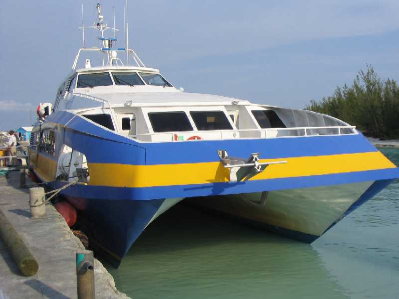
We left Nassau four days ago bound for Royal Island 38 miles to the NE (a few miles north of the north end of Eleuthera), where we found a delightful full-protection anchorage next to an uninhabited island with an astoundingly extensive set of ruins from what was obviously a thriving resort of 1940's-50's vintage. This was followed by a short 7 mile jump east to Spanish Wells, the most industrious and attractive town we've seen anywhere in this country, and where, irrespective of the small size of the town, you can get just about anything. We parked the boat there on a mooring and took the "fast ferry" Bohengy out to the north and then east along the rock- and coral-studded "Devil's Backbone" along the north end of Eleuthera (where we did not want to take Wind Song) to Dunmore Town on Harbour Island for a day trip. The Bohengy, a large (~100 foot) power catamaran, does the trip at 35 knots, literally dodging hard obstacles all the way. The whole trip takes 20 minutes. Here are some photos.
Fast ferry Bohengy
tied up in Spanish Wells
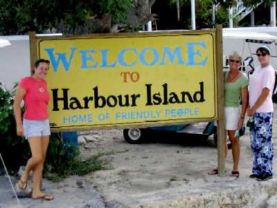
We arrive at Harbour Island,
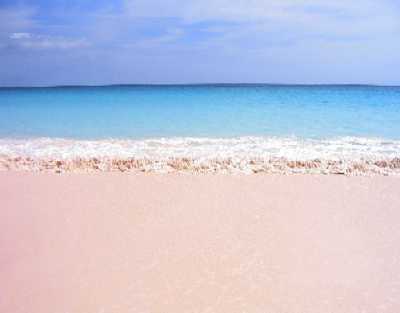
home of the world-famous pink sand beach.
The friendly people are there
too, though Spanish Wells should get the grand prize for that.
 _
_
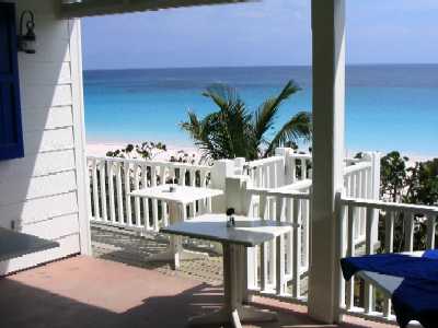
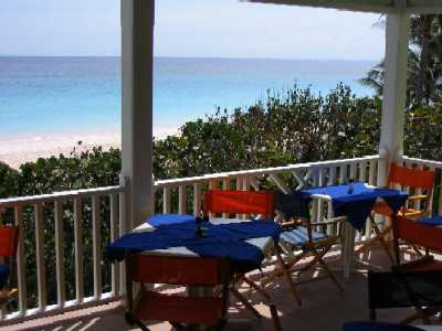
Above the pink sand beach,
naturally, is a bar and restaurant, called Sip Sip, with a classic tropical
beach/ocean view. Expensive though.
 _
_
Since we didn't want $15 burgers,
we walked back into Dunmore Town to the Dunmore Deli, where prices were more
reasonable.
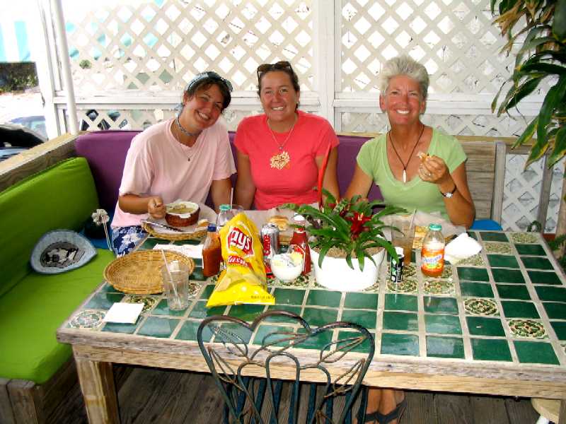
Three of us had nice, safe
sandwiches while Roxanne had the conch chowder. Conch is a large salt water
snail for which the Bahamas are famous..
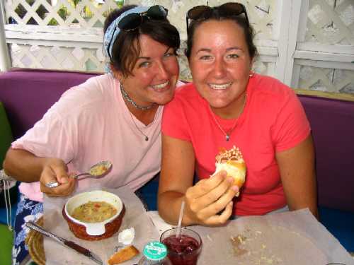
However, if there's anything
slimier than a garden snail, it's a salt water snail. Everything depends
on the skill of the chef.
This was our first meal out
since burgers at Chat 'n' Chill in Georgetown.
 _
_
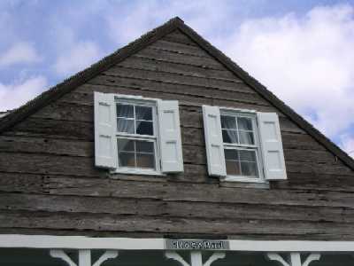
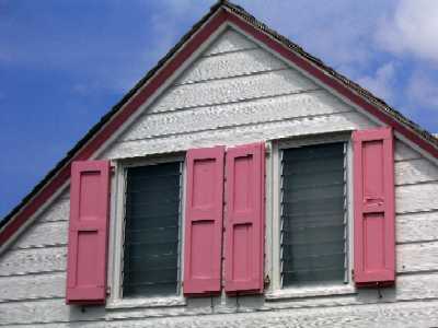
Nearly all houses in the Bahamas
have real, functional shutters -- for hurricanes.
A lot of the houses also have
names. The one on the left below is "Rosebud".
 _
_
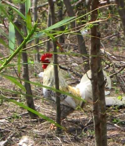
Like all towns in the Bahamas,
Dunmore Town also has chickens. Lots of chickens, just running around
mindlessly, crowing, mating, having chicks, and generally doing everything
they can to make sure no one in the Bahamas ever runs out of chickens.
 _
_
We departed Spanish Wells at daybreak on Tuesday March 15th, motored two hours to a treacherous, current-ridden cut, called (really) "Current Cut" -- timing it (we hoped) for slack water. This was somewhat difficult for a first-timer because the tide heights on the two sides of the cut are 2.5 hours different, and slack water occurs when the two heights are the same -- not when one side or the other is at high or low tide. We were lucky in that shortly before we arrived at the Cut another yacht came through from the other side and he was monitoring his VHF radio, so we were able to get the conditions from him. The problem here is that the far (SE) side of the cut (as we traversed it) requires a hard right turn around a barely visible submerged rock into a very narrow and shallow channel with rocks on one side and a reef on the other. One's boat (we discovered) must be positioned laterally to something like half a boat length for this to work -- impossible to do when the current is flowing four to six knots sideways across this segment.
From there we motored on down another 31 miles to Governor's Harbour -- bypassing Hatchet Bay (even though we knew a front was coming) because it was described as grubby and unattractive with very poor holding ground in one of our cruising guides. We figured we'd go on down another 25 miles to Rock Sound for the front. The wind for the next day was predicted (by the Nassau Meteorological Office, which is just plain wrong most of the time) to be E-SE 10-15 knots -- perfect for a due south course. Instead it was 20-25 SE-S with short, steep waves five feet high that drenched us, nearly stopped Wind Song in her tracks, and caused us to be unable to lay the course even though we were motorsailing. After five miles of misery we gave up and returned to Governor's Harbour in despair, knowing we'd be dead meat there when the front came. We thought about Hatchet Bay, but since its entrance -- literally a 90 foot wide cut through a solid rock cliff -- was at the time being swept by the same seas that had been throwing Wind Song around all morning, Lane did not feel that the risk of sailing another 18 miles downwind into a lee shore cul-de-sac only to find the cut impassable was worth taking, because if we couldn't get in we'd be spending the next two nights and days at sea in rising winds, with a rockbound shore under our lee and no shelter anywhere we could get to. Welcome to Eleuthera.
Fortunately another yacht came in to Governor's Harbour that had had experience in the area and he told us that the cut at Hatchet Bay, while dicey in five foot cross seas, was safely negotiable with care and active steering, and that in fact he himself would be there the next day, in what were predicted to be worse seas. Of course, he had a boat with a fin keel and spade rudder, not a shoal draft Chesapeake Bay bugeye.
So we went, spent three hours under jib and mizzen doing six knots in breaking quarter-seas, our worst problem being the snap loads on our inflatable dinghy that was under tow. In the end it survived, and the cut was as advertised: dicey, rife with backwash from the cliffs, and not a good place for a neophyte, but make-able if you really knew your boat, because the helmsperson had to anticipate and prevent course deviations, not just correct them when they occurred, during the approach and actual entry into the cut -- because there literally wasn't room to let them occur. Once Wind Song's stern was between the cut walls, the danger was past.
And inside? It is a LAKE. Yes, the holding sucks -- the bottom is thick thick weed-like algae growth -- but it turns out there are a number of government-placed moorings here and they are FREE for as long as you want one, assuming there's one available when you show up. When we got here there were three to choose from, the remaining eight or ten being already occupied.
And now we wait. Tomorrow morning should be
interesting, because more boats have arrived and some have had to anchor --
and when the wind shift comes in the morning they'll be directly upwind of
us. We hope they've got multiple anchors out.
March 18, 2005
The front arrived as scheduled at dawn this morning with blustery winds and rain. The rain was over by mid-morning but the winds continued through the day, abating slightly in the process. We never saw the 30-40 knot squalls, but did get a steady 25-30 NW for most of the day. Nobody here had a bit of trouble. It started to calm down toward evening, but right now it's breezing up again. We care about all these little fluctuations because we'd LIKE to travel down to the bottom of the island tomorrow, but not if it keeps blowing. We need the seas to lay down.
This report has been put off so long that there is a lot of material backed up, and we're frankly not feeling all that hot about trying to get caught up. The biggest news is clearly what we wrote yesterday, and in fact since "coming to Jesus" in Nassau we feel as if we've been shot out of a cannon -- kinda like when we left Florida back in November. So let's just back up about three weeks, to when we were anchored off Thunderball Cave at Staniel Cay.
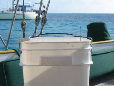
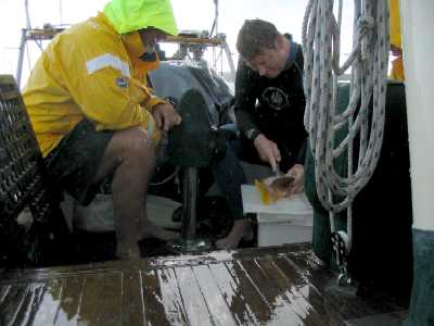
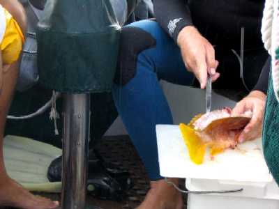
So one day while we're at anchor See World showed up to get fuel at Staniel Cay, then vanished off somewhere, and later that afternoon Bob reappeared in his dinghy, clad in a wetsuit, handed up a plastic bucket, and swung aboard with a filet knife in his hand.
Bucket -- with telltale lobster
antenna showing.
Bucket contents, 1 snapper and 1 small lobster.
 _
_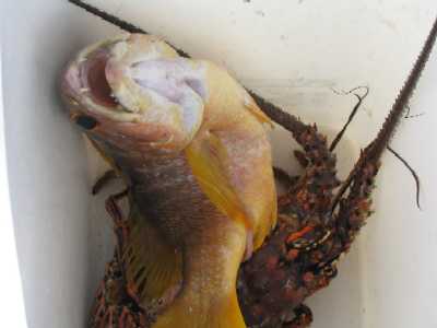
In pouring rain Bob gives
Lane a quick lesson in how to filet a fish without "cleaning" the fish (removing
the guts) first. We didn't even know this was possible, but in fact it's
fairly easy.
BTW, the observant reader
will have noted that in the time between these two pairs of photos, the
weather shifted from bright sun and blue sky to clouds and rain. Just another
spring day in the Bahamas.
 _
_
Needless to say it all tasted great that evening at dinner, sauteed in butter and served over brown rice. The next day we moved north a few miles to anchor in a small hole on the edge of a large shallow area ringed by small cays, called Pipe Creek, named after the cay on the western side of the area, Pipe Cay. Tania stayed aboard doing schoolwork while Lane, Lynn, and Roxanne took a "constitutional" over toward the east shore of Pipe Cay through the shallows, hoping to get ashore and take a walk. It being nearly low tide, this was difficult, so we anchored the dinghy in about six inches of water and waded the rest of the way with the tide still ebbing.
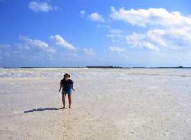
This is what a few square
miles of "salina" look like after the tide goes out. All those small specks
under our feet are the shells of tiny sea snails -- millions of them.
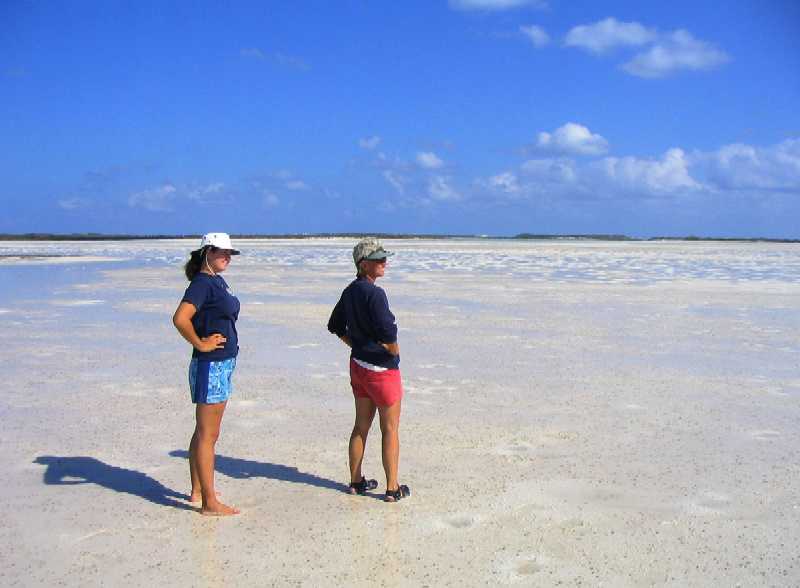
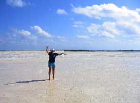
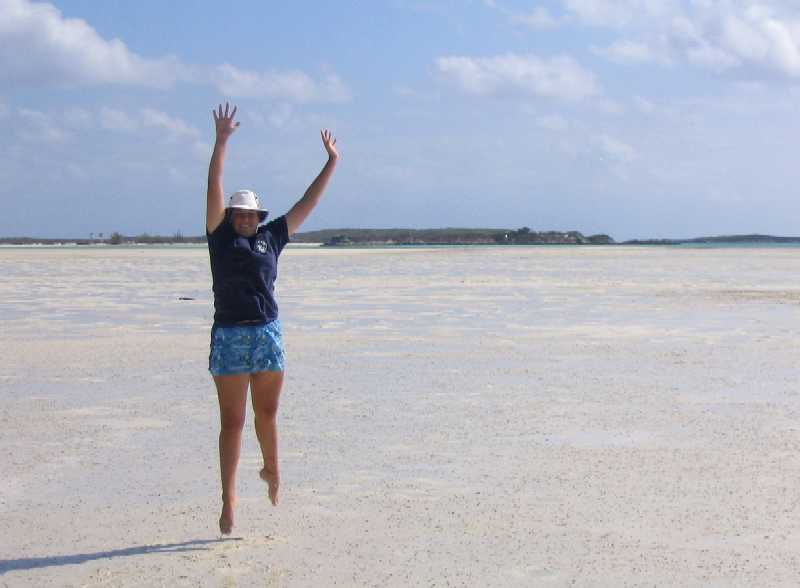
Over to the right where Roxanne
and Lynn are looking, there are numerous holes and channels where boats
can anchor in what are essentially tide pools -- deep enough to float a
boat but surrounded by dry sand at low tide and escapable only at high tide.
Talk about perfect protection!
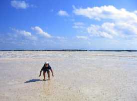
Roxanne decided that this
place begged to be treated as a canvas for performance art -- namely, jumping.
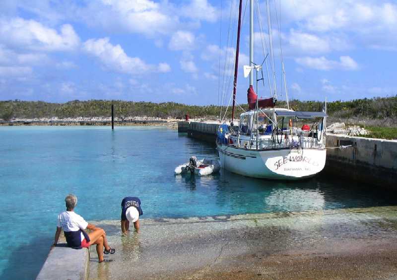
Moving on, we got to the east shore of Pipe Cay, where we looked for and finally found a small trail that crossed the Cay to an abandoned Navy Decca station on the west side, complete with a 100 foot long cement quay and huge bollards for tying up Navy ships, in a dredged harbor with almost complete protection (exposed only to the west) -- and who should we find there but See World!
Genna, prancing innocently
around in her birthday suit, seemed ready to follow Roxanne anywhere.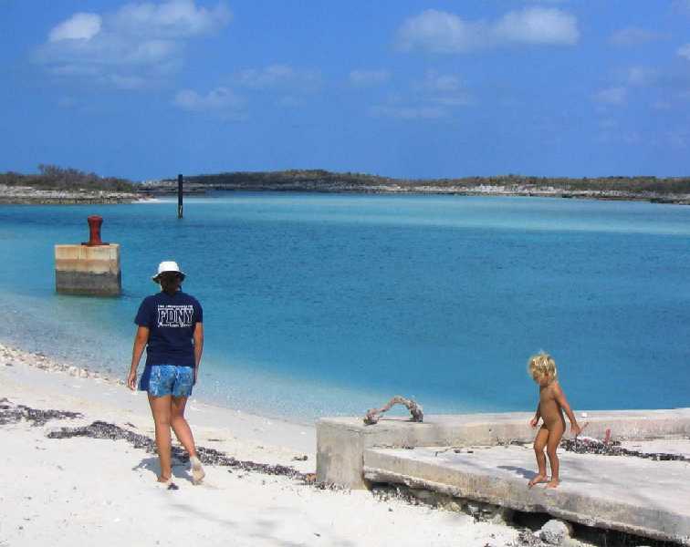
This all seemed just too idyllic to pass up, so while Roxanne stayed to play with Bobby and Genna, Lynn and Lane hiked back across the island, portaged the high-and-dry dinghy a hundred yards to the nearest water, motored back out to Wind Song (which was not in a landlocked hole), raised anchor with Tania's help, and motored around the cay to tie up in front of See World on the wall and spend a day or two with them. As day faded to evening, passing clouds and a light breeze kept things cool. A perfect, flat-calm night ensued, during which all of us slept like rocks.
Next morning, Roxanne poured her morning cup
of coffee and went on deck to check things out, where she found Genna running
around looking for entertainment. They sat together on the edge of the quay,
discussed the options, and . . .
 _
_
. . . spent the next half hour examining the
wreckage of a boat on the bottom of the harbor just in front of Wind Song
(below left).
Meantime Tania (below right), using Bahamian
native plaiting skills she learned from Bob the previous evening (Bob's full
of all kinds of knowledge), showed off her first product: a bookmark made
from fronds of the native palmetto that grows everywhere on these cays.
 _
_
That evening, after a blissful day of calm, bright weather perfect for snorkeling and exploring, Wind Song hosted a pot luck dinner with all the See World crew plus a couple from the trimaran Hailstone -- 10 people in the cockpit, and Wind Song has one of the few cockpits around here spacious enough for that (which is why she's so small below deck!).
See World moved on the next day, but
not before we got this picture of all of them together. It reminds us of
ourselves about 13 years ago.

We left as well, moving on to Cambridge Cay, of which you've seen pictures earlier, and from there to Warderick Wells to get water, sit out a front, and finally meet Park Warden Ray Darville again, 11 years after first making his acquaintance.
Sadly, he was not there. Much more sadly, he would not be returning. He'd been fired a couple weeks earlier, he'd taken another job in Freeport (for about three times the salary), and he had already moved there.
Which almost makes it sound as if he quit for a better job, but that's not what happened. In any large organization, it is a truism that people can come or go but the bureaucracy stays and grows -- one might even say, festers. It would appear that the Bahamas National Trust is no exception. Ray was removed by the new BNT Director through his subordinate National Parks Director in what one might call a "typical bureaucratic stratagem" (ass-covering ruse), manufactured to allow Ray to be terminated without the real reason for it ever to surface.
There is now a new American duo running the park. Some of the volunteers call it "The Tom & Judy Show". They showed up a few days after Ray's departure, with all the requisite paperwork already in place in a country where it is illegal to hire foreigners for any job for which qualified Bahamian candidates exist. We have few details, so it is not possible for us to report what happened reliably, but the details we do have leave a very sour taste and lead us to wonder about the future of the Park. A lot will depend on whether the volunteers who have held the place together for so many years continue to participate -- we know some who do not plan to.
There is an additional factor that has been present all along and has nothing to do with the Park leadership, and of which we were previously unaware, that has a large negative effect on the Park and can only be corrected by decisive government action, and that is the no-take enforcement situation. The law is clear -- fishing there is illegal -- but the evidentiary requirements for a poaching conviction are absurdly high: poachers must be caught not just red-handed but literally in the act. A pile of just-caught fish still flopping in the bottom of the boat is insufficient. What is worse, poachers who live in Black Point (which is most of them) are held in the Black Point jail for trial, where they are often released with charges dropped by their "friends in government" within hours of being caught.
This situation means the Park no-take law is essentially unenforceable, which in turn means the existence of the Park as a marine fisheries refuge and feeder zone is negated. When this is coupled with a similar situation regarding preservation of the lands in the Park in their natural state (real estate developers, in the presence of a government that hasn't the political will to use the eminent domain laws, are finding legal loopholes in the form of "grandfathering" clauses that allow them to do pretty much anything they want inside the Park), it means that the Park is becoming, and may already be (or possibly always was), meaningless.
For practical purposes, with the exception of Warderick Wells Cay which the BNT owns, the Park does not currently exist except on paper. The Bahamian government does not support it legally, politically, or financially. It is financially supported entirely by direct-to-the-Park contributions, almost entirely from the US & Canada. It was built entirely by volunteer labor, almost entirely from the US & Canada. Money the Park makes (from T-shirt and book sales, for example) reportedly all leaves the Park and goes to other BNT Parks. The one person all these contributions to Exuma Park centered on was just fired. We are left wondering, does the Bahamian government have any real interest in this Park whatsoever?
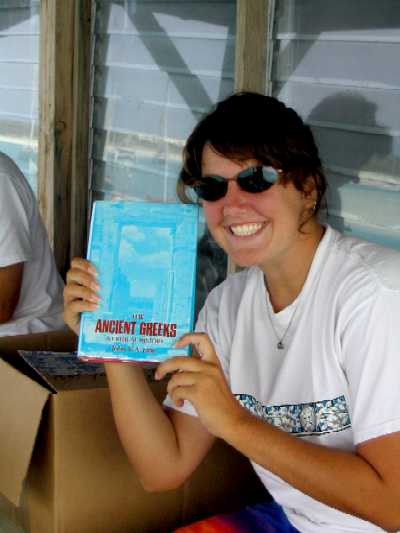
Sigh. OK, it's still a nice place. We love it there. This management situation makes it bittersweet for us now, but Lynn decided to go ahead with her plan to volunteer during the course of our stay. She really enjoys the opportunity to work with other cruisers and get to know them, and to contribute to the Park. She spent several days laying paving stones on the path between the HQ and the Warden's residence, doing trail maintenance, and folding T-shirts which had just arrived in a huge shipment.
On the veranda of the Park
HQ, the view distracts Tania briefly from her schoolwork. Below left, Lynn
folds T-shirts for sale inside while Roxanne reads in preparation for St.
John's College in the fall.
 _
_
Roxanne reads what? "The Ancient
Greeks", of course. Later, with her feet up on the rail, this is the view
if she raises her eyes from the page.
 _
_
OK, now it's time for a happier story than that of the Exuma Cays Land and Sea Park. You may recall we said we planned to take Wind Song back to Oxford, MD, where, we were told by her first owner, Bill Kay, she was built, and to confirm her heritage there and start looking for her next owner. Well, her heritage has now been confirmed. In spades.
The channel in the Warderick Wells Cay mooring
field is very narrow and has boats moored smack in the center of it --because
if they didn't moor in the center, they'd hit land on one side or the other.
It looks like this from Park HQ:
You can see that when one enters this area (from the far left), one is required to pass very close to the moored boats in order to avoid hitting either the rocky foreshore (on the right in the photo) or the sandy shoal (on the left in the photo).
When we entered this harbor on Feb 23, one of the boats we passed in this manner was a light gray Brewer 42 center cockpit cutter by the name of Jennie Marie, owned, it turned out, by a gentleman named John S. Labat, who hails . . . (pregnant pause) . . . from Oxford, MD. As Wind Song passed by no more than ten feet from his port rail he was standing on deck watching us. His mouth started to open. As we came abeam his jaw began to drop until he was simply agape, his mouth working like a fish out of water, as if to form words but none would come. Lane thought to himself, "That guy's either trying to figure out what make of boat Wind Song is, or he thinks he's seen this boat somewhere before. But either way, he's wrong." And we went on to pick up our mooring.
Not much later we were talking to one of the volunteers we knew, and in passing he said, "Oh by the way, the guy on that gray boat over there says he built your boat." Klunk. This time Lane's jaw dropped.
Check this out.
Below, left to right:
Woody Labat,
John's brother
John Labat
Don Loweree,
Wind Song's builder
Rob Ladd,
Wind Song's designer, of Kaufman & Ladd Yacht Design, Annapolis,
MD
Wind
Song's frame mold is in the background.
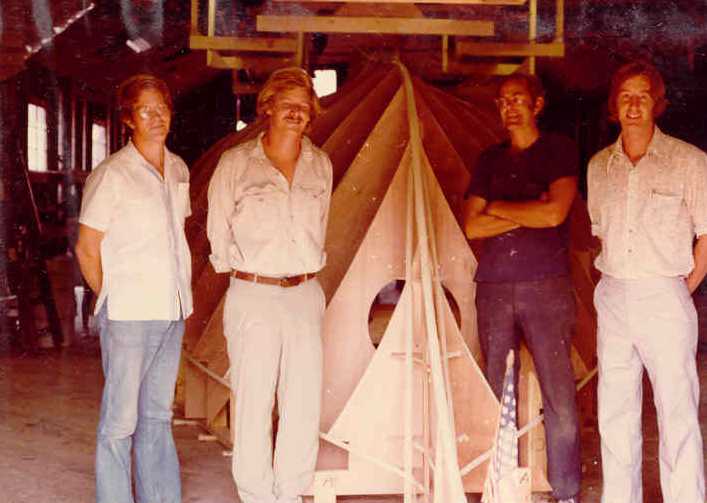
This photo was taken (we found out from John) in Fall 1976 in a leased boat shed at Crockett's Boatyard, Oxford, MD -- which is now Hinckley Yachts, the creme de la creme, where the 38 foot, $750,000 Hinckley "lobsterboat yachts" are built. John and Woody worked for Don Loweree throughout Wind Song's construction. They were in their early 20's.
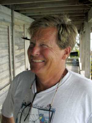
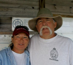
John Labat, Feb 2005. Taken
on the veranda of Exuma Park headquarters on Warderick Wells Cay.
 _
_
Needless to say we spent a LOT of time with John, and we learned a LOT -- too much to cover here, but here's a sample:
• Wind Song was the last boat Don Loweree built. He subsequently moved to New Mexico.Meeting John like this has been wonderful, partly of course because it turns out he's just a great guy, but partly also because it is so sweet to hear all the history behind this boat, the details, the personalities, the anecdotes. John can sit in Wind Song's cabin, point to individual pieces of joinery, and tell the story of how that piece got made and fitted. He knows all the construction details, which type of wood was used where in the interior, and so on. Plus he knows Oxford, having lived there for decades. This all having happened, it simply confirms for us that our first stop in the Chesapeake has got to be Oxford. And it makes a great story for the ad Lane will be writing!• The building Wind Song was built in did indeed burn down not long after she was launched, taking her molds with it. It was rebuilt, and subsequently burned down a second time. The current building on the site (in the Hinckley yard) is the third.
• Every morning at the start of the workday Bill Kay would call the yard from his home and say "I've got an idea." Nine times out of ten he'd call from his bathroom while sitting on the toilet (he'd put a phone in there) -- to the point that they began to ask, "Bill, are you calling from the throne?" And if he said yes, they'd say, "Bill, no more calls from the throne! Finish up and call us back when you're done!"
• Bill Kay did not live in Oxford or even on the Eastern Shore. He lived alternately in Indiana and Pennsylvania, but kept Wind Song in Oxford for all the time she was on the East Coast, and sailed her from there. A guy named Tommy Campbell did all her maintenance and repairs. He currently owns three boatyards in Oxford, called theCampell Boatyards.
• John and his brother Woody stayed in the boat business in Oxford after Wind Song was finished, but as John said, "There wasn't room for two Labat marine service companies in a town of 700 people", so he took his woodworking skills and entered the home building & remodeling business. Woody ended up in high end home cabinetry, still in Oxford. John lives aboard Jennie Marie at a friend's dock in Oxford, working during the warm half the year and cruising the other half.
• John confirmed that Todd Taylor, an Oxford yacht broker who had been recommended to us by another cruiser, would indeed be a good person to represent Wind Song for sale, so we'll try him when we get there. However, we'll put her on the Internet before that and see if we can sell her that way first.
A footnote: Back at Williams Bay on Lee Stocking Island we met a guy named Pete Dawson aboard the Great Lakes 33 trawler Scooter (here's his boat), and he gave us the name of a guy in Oxford, MD with whom he insisted we make contact, name of Ed Thieler. So we did. When this Warderick Wells/John Labat thing happened, we emailed Ed again and told him the story. He has since emailed us back. Turns out Woody Labat is a "very close personal friend" of Ed's, and also a high-end master carpenter and cabinet maker in Oxford. If this sort of thing keeps up, by the time we get to Oxford we'll know everyone in the town.
And now, farewell (for this cruise -- we think) impressions of Warderick Wells:
(below left) Roxanne
and Tania's official "Dad's a dweeb" photo for wearing socks with reef walkers
for a hike on the island.
(below right) Dad's
official "Like I care!" 'tude because reef walkers are all the footwear
he's got left, and socks prevent blisters.
 _
_
One favorite cruiser pasttime
during good weather in Warderick Wells is to hang out on the HQ veranda after
working hours to watch the sun go down. Just doin' nuthin'.
 _
_ _
_
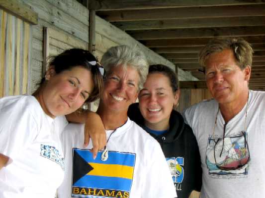
A few of our favorite people from this visit:
(left) Buzz and Glenn from the trawler Bold Eagle, Green Bay, WI. Radio call signs are "Wizard" and "Band Aid". For nearly a year, up until the recent regime change/palace coup, Buzz ran the HQ office while Glenn ran the physical plant. Now it is doubtful they'll stay on.
(middle) Just Larry, permanent live-ashore head Park volunteer. Radio call sign is "Gilligan". Literally lives in a shack. He gives out the volunteer work assignments each morning. Larry has terminal skin cancer. This is how he's choosing to live out the days he's got left.
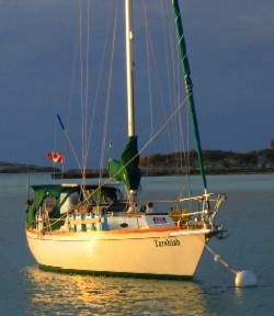
(right) Ruth and Bill
from the sloop Tarshish, Little Narrows, Nova Scotia. Just your average
volunteers, they volunteer whenever they are there.
 _
_ _
_
(left to right) Bold Eagle,
"Gilligan's" shack, Tarshish.
 _
_ _
_
Roxanne and Tania nerdle over
to the sandbank at low tide as sunset comes on.

Back aboard Wind Song,
Tania strikes a pose in the reddening light.
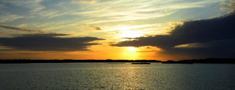
Sunset at Warderick Wells.
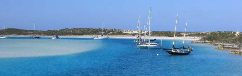
From here we proceeded north to Robert's Cay, which proved to be so tight we had to put out two anchors to keep us off the shoals, then bailed the next morning for a roomier anchorage three miles south at Allan's Cay, and finally back to Nassau the next day. Which brings you back to the top of this page.
23° 31.25' N, 75° 46.35' W
Hole #1, Stocking Island, Exumas (aka Volleyball
Beach, Georgetown)
March 24, 2005
You can see from the LAT/LON that we've moved on a bit. From Hatchet Bay, Eleuthera, our predicted three-day weather window shortened to two days, to be followed by a week or so of E/SE winds in the 15-20 knot range (right on the nose), and with protection marginal to nonexistent at Cat Island we elected to blow off Cat and go directly to Georgetown overnight, 120 miles away. We made the passage almost entirely in dead calm conditions, arrived at Conch Cay Cut (the western entrance to Elizabeth Harbour) at 0600 Sunday, made our run through the reefs and shallows as soon as there was sufficient light, and put our anchor down off Volleyball Beach at 0700. It being a Sunday, Tania was out and about with Gregg by 1000. In fact, today (Thursday) at the moment this is being written, the two of them are in Gregg's skiff next to our starboard rail because, for a change, Gregg got Tania back for Wind Song's dinnertime a few minutes early, and they refused to part until the requisite 6 pm straight up.
So here we are. Again. And it is HOT. And HUMID. The spring southerlies are starting to dominate the weather, bringing tropical heat and humidity north to this area. We just deployed our cockpit sun awning for the first time since Florida. Tania is ecstatic to be here, and Roxanne is in shock again at the crowds of cruisers. We spent last night down in our hurricane hole, Crab Cay Hole #2, aka "Cupcake" (cuz that's where the "cupcake" cruisers go when the wind blows, and boy that describes us on Wind Song, and no apologies either), where Roxanne was happy with the solitude and serene beauty while Tania counted the minutes until she was released from her "prison". Then this morning early (to grab the 0700 high tide) we brought Wind Song up the very shallow "dinghy channel" to Kidd Cove, immediately off the entrance to Lake Victoria in Georgetown, where we did errands and Internet all morning. Then back to Volleyball Beach by 1:30 pm, just in time for Tania's "afternoon social activities".
Now that we're here, the three questions in the air are 1) When shall we leave Georgetown?, 2) Is there anyplace else we should visit down here before returning to Florida? and 3) By what route should we return to Florida? And at the moment we don't have answers for any of them. We do know we have to be back by April 27th, and since Miami is 300 nautical miles away we know we'll have to leave no later than April 17th, because the absolute fastest scenario takes 5 days and it could easily take twice that.
(To put this in perspective, one of the Stocking Island shore-based residents here just yesterday flew to Miami to pick up his new 40 foot, 3 outboard, 675 hp "cigarette"-style speedboat. They brought it back today. In one day -- including the time necessary to bring it through Customs and for the crew to clear Immigration across the bay in Georgetown. They just motored past us on the way to their dock. It is 6:30 pm.)
We also now know we'll be staying not in Ft Lauderdale or West Palm Beach but in Miami while Tania is off in CA, because we have received information that it is much easier for cruisers to hang out in Miami than anywhere else in Florida, and we have a lot of local information. However, since it is unlikely we'll figure all the rest before this report must be posted (and since the chances of us sticking to ANY plan would appear to be nil anyway, so what would be the point?), we'll just close this off now with the assurance that we will get Tania onto her plane from Ft Lauderdale to LA on May 1st, one way or the other, and that after it happens we'll tell you how we did it.